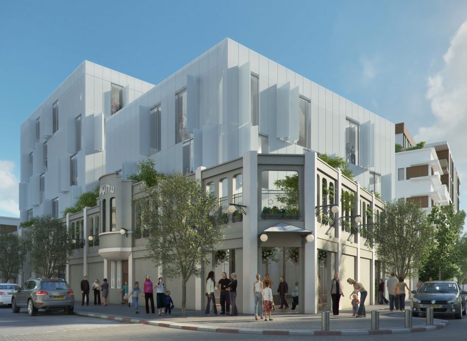


Nahal Pardesim East Neve Sharet, Tel Aviv
key facts
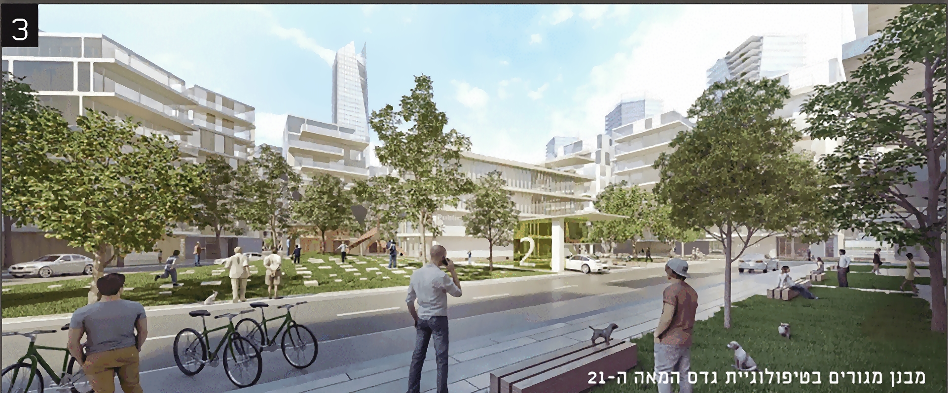
Neighborhood planning including 4,500 residential units, winning first place in an architecture competition conducted by the Tel Aviv Municipality in 2015.
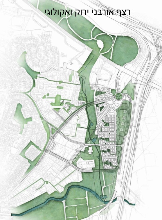
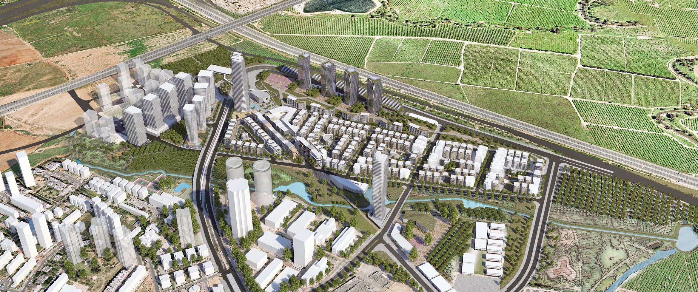
The Nahal Pardesim neighborhood is a new neighborhood situated among the last available land reserves in Tel Aviv, adjacent to and continuing Tel Aviv’s constructed urban territory. Located to the east of the Neve Sharet and Kiryat Atidim neighborhood, north of Ramat HaHayal, and west of Highway 4, which is a national arterial road – forming an urban partition to the east.
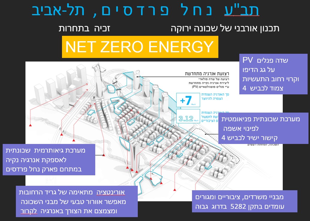
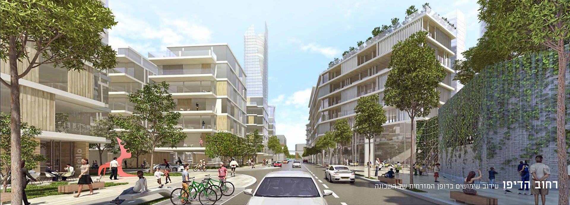
Significant green elements are planned in the project, including a green Depot Park of 100-meter wide strip situated on the east side of the neighborhood. including: net-zero energy using a 30-dunam solar field, a geothermal field, a continuous strip of green roof, a pneumatic waste disposal system, and the implementation of a smart city – a control and supervision system for energy and water systems of public spaces.
Award winning of architecture competition
Dunams
Project details:
Location: East Neve Sharet, Tel Aviv
Architect: Kimmel Eshkolot Architects
Entrepreneur: Tel Aviv Municipality
WAWA operations: Green architecture consultancy, wind simulation, shading simulation, and parametric design.
Building category: A neighborhood that consists of residential, commercial and office space, and public buildings.
Challenges
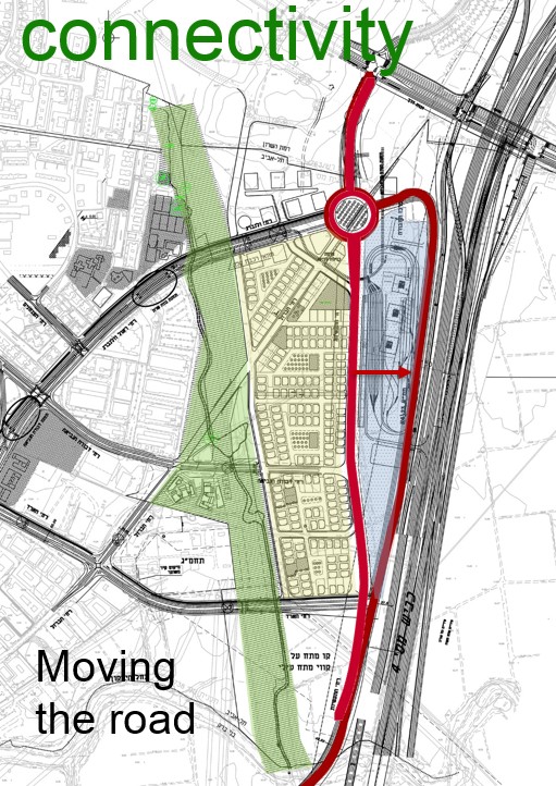
Maintaining the urban continuum and connectivity to adjacent neighborhoods despite the obstructing urban elements such as Highway 4, the wide, noisy industrial road, and the Depo complex – the light rail’s maintenance complex.
A correct green approach to Nahal Pardesim – an overlooked seasonal channel to the west that allows the creation of a substantial green lung in north Tel Aviv.
Creating a neighborhood whose energy consumption meets the objective of greenhouse gas emissions set for 2030. Beyond this, it would include minimal water consumption, and optimal treatment of recycling and waste.
In the stage where we were assisted by parametric analysis, the project plan was already at an advanced stage, and there was a sense that proposing constructional changes and the moving of structures was no longer possible. The key challenge was to find the ability to withstand sustainable planning with minimal changes.
Added value
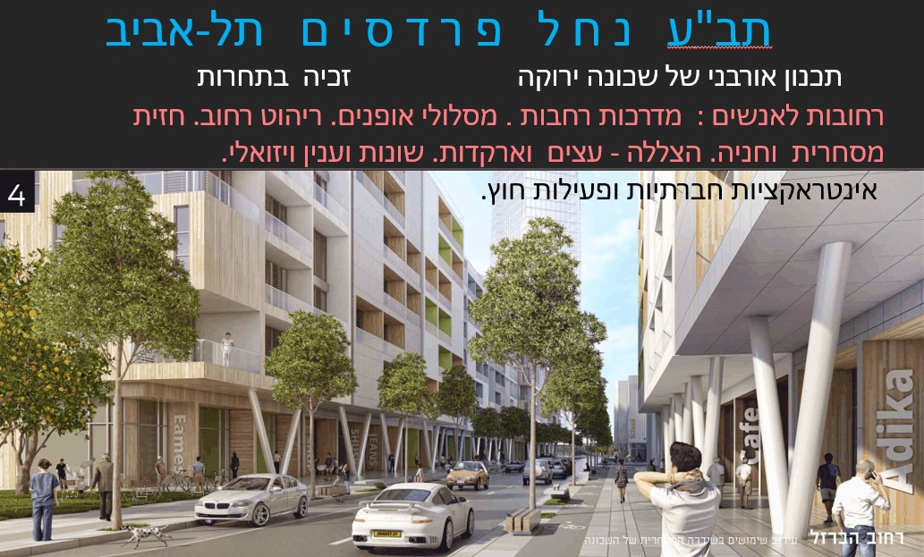
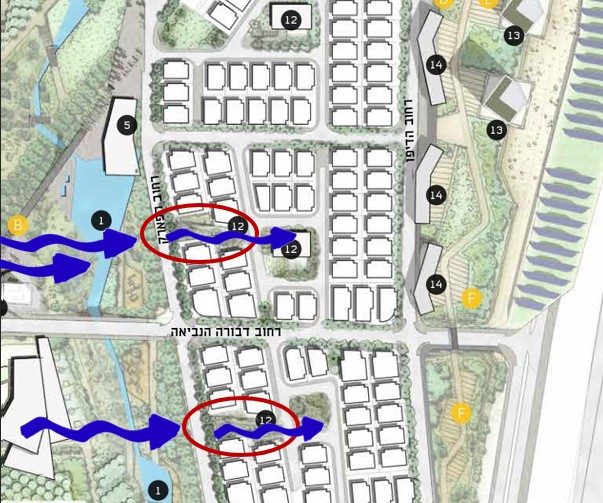
- Green solutions for the project include the utilization of wind for natural ventilation – planning grid directionality in accordance with the wind regime of the region, lowering the temperature in the neighborhood by planning a developing and expanding a water canal for wider pools opposite the developers on the west side of the neighborhood, a continuous green network for pedestrians and bicycles that links all areas of the neighborhood, and extending open land by designing mostly underground parking.
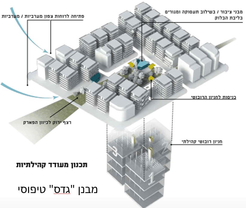
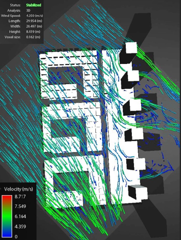
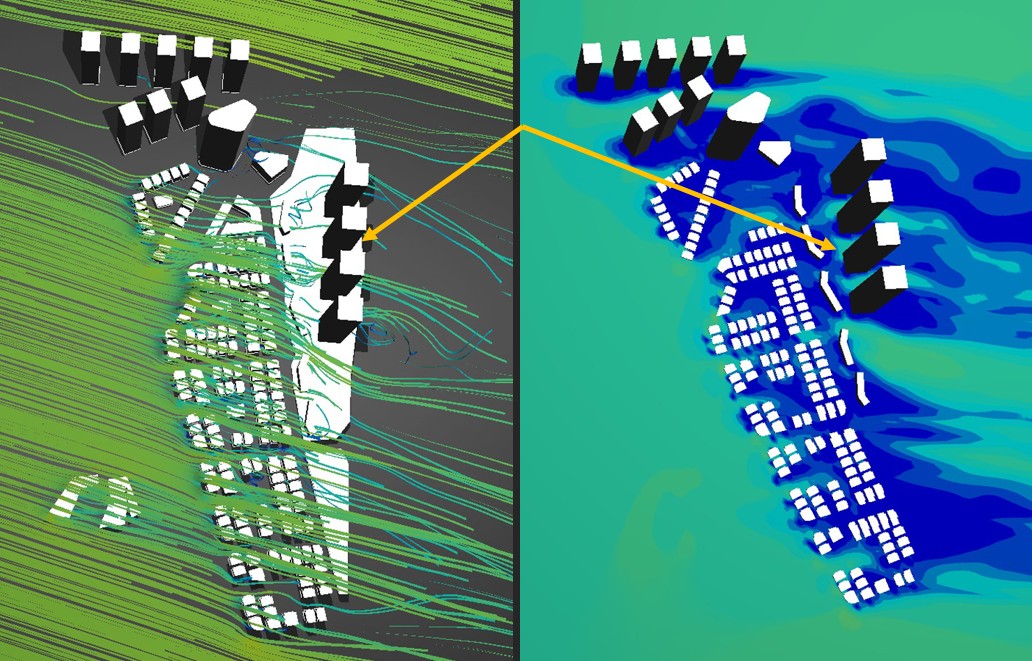
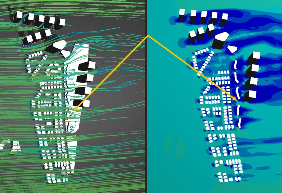
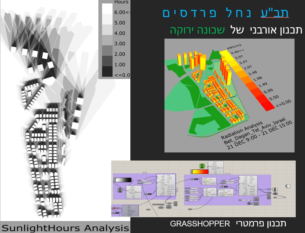
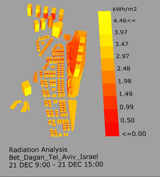
- The use of parametric design in the project enabled the optimal utilization of the neighborhood’s natural conditions, such as: optimal sun accessibility in all the buildings, optimal planning of building height while preserving rights to light and building rights, planning street direction according to wind direction in order to enable ventilation for all the buildings, utilization of the sun and of geothermal energy to supply electricity for the public areas throughout the entire neighborhood complex.
- Advanced simulation analysis and parametric design paved the way for examining the global layout of the neighborhood, The outline was that the preservation of building rights and of conditions necessary for rights to light, shading, and the character of the constructed buildings (high-rises, low-rises, etc.) was imperative. Performing parametric analysis allowed us to examine many options within a short period of time, and to reach an optimal solution which was then backed by simulations we ran. Without a doubt, this process contributed to correct project planning, and served as yet another significant factor in us winning first place in the architecture competition as part of the design team.
- WAWA joined the design team at the outset of the project. This led to brainstorming and integrative planning accompanied by in-depth analyses and feasibility simulations over the entire course of the design. Computerized analyses were used to understand wind directionality in order to adapt the width and direction of the streets in the neighborhood, sun exposure analyses enabled the correct positioning of the buildings and the diversion of some of these buildings in order to maximize their ability to benefit from rights to light, even in the future planning stage. In effect, it facilitated the creation of an optimal, correct design that substantially contributed to winning the competition.